
Listed by name. See the routes listed by distance.
| Route Name (distance in miles is approx.) | Map | Surface | Hills? | |
| Battery Kemble Loops | 10 | paved trail and road except for BK dirt trail | yes | |
| Battery Kemble Loops (modified) | 16 | paved trail and road except for BK dirt trail | yes | |
| 16 | paved trail and road except for BK dirt trail | yes | ||
| C&O Canal | out/back | towpath is all dirt and small rocks | none | |
| Capital Crescent | out/back | Link | all paved trail | uphill away from DC |
| Capital Crescent Detour | 12 | paved, dirt trails, city streets | yes | |
| Capital Crescent Rock Creek CCW | 22.5 | mostly paved trails, short hard-packed dirt trail | yes, gradual | |
| Capital Crescent Rock Creek CW | 22.5 | mostly paved trails, short hard-packed dirt trail | yes, gradual | |
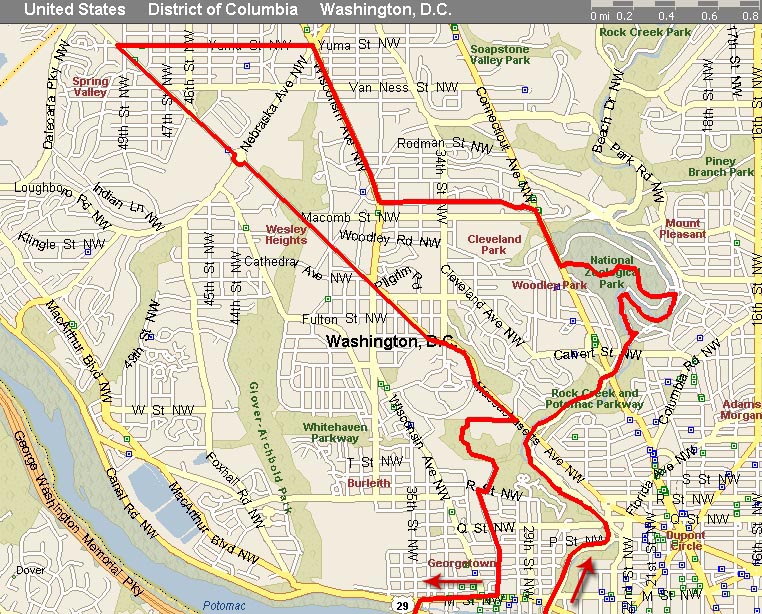
| Cathedral+Clintons | 13 | JPG | mostly paved trails, sidewalks; short dirt trail | yes |
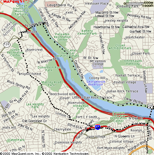
| Chain Bridge Loop | 10 | GIF | half paved, half towpath | yes |
| Cleveland Park+Cathedral+Clintons | 15.5 | JPG | paved trail, city sidewalks, short dirt trail | yes, very hilly route |
| Glover Archbold | 10 | Glover is all trail, several street crossings | rolling | |
| Glover Archbold Pandas | 13.5 | Glover is all trail, then sidewalk and paved trail | rolling, big downhill thru zoo | |
| Glover Mass Ave Crescent | 13.5 | some trail, rest paved | gradual | |
| Glover to Rock Creek (Melvin Hazen Trail) | 14.5 | Glover is all trail, then sidewalk and paved trail | rolling | |
| Glover to Rock Creek (Soapstone Valley Trail) | 15 | Glover is all trail, then sidewalk and paved trail | rolling | |
| Glover to Rock Creek (Tilden) | 14 | Glover is all trail, then sidewalk and paved trail | rolling | |
| Glover/Potomac Ave/CapCrescent | 11 | paved, dirt trails, city streets | yes, Mt Garfield | |
| Klingle Rd to Cortland | 13 | paved trail and city streets | yes | |
| Klingle Rd to Newark | 14 | paved trail and city streets | yes | |
| MacArthur route by Becky | 13 | paved trail, city streets | yes | |
| Marymount Chain Bridge | 14 | paved trail, roads, and sidewalk until towpath | yes, several big ones | |
| Mt Vernon Trail | out/back | all paved trail | no | |
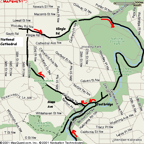
| Normanstone-Klingle Loop | 13 | GIF | paved trail, dirt trail, city streets, sidewalks | yes |
| Pentagon Army Navy | 12 | paved trail, sidewalks | no | |
| Pinniped (Zoo) Route | 11 | paved trail | hill in the zoo | |
| RFK Loop by Jodi | 12.5 | paved trail and city streets | no | |
| Rock Creek Park | out/back | all paved trail | rolling | |
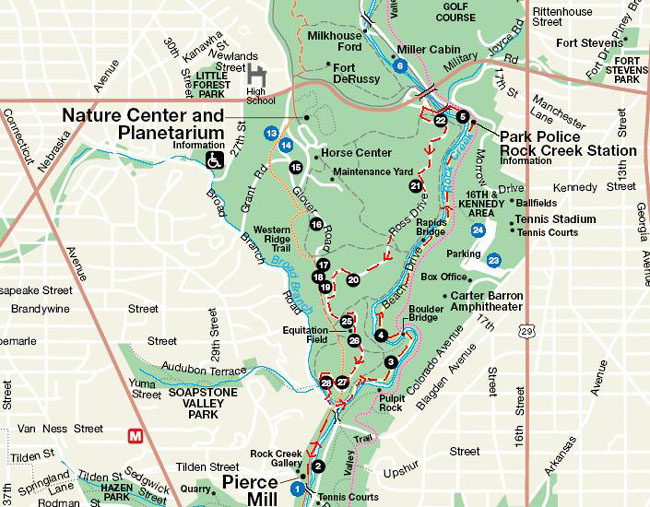
| Ross Drive | 14 | JPG | paved trail and streets | yes |
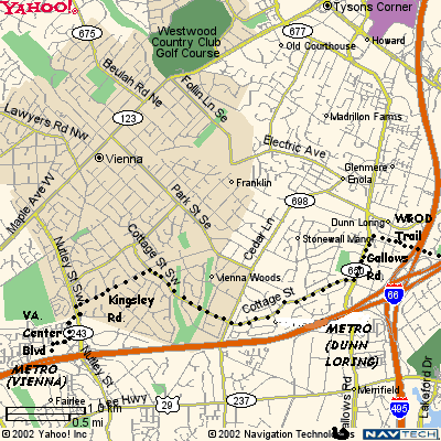
| Vienna Metro Point to Point | 14 | GIF | all paved trails | yes |
Back to SLR
Routes or ![]()